search expand
Skip to content
  • HOME
  • Intro
  • Maps
  • Webcams
  • Geysers
  • Wildlife
  • Geology
  • Lodging
  • Camping
  • Hiking
  • History
  • News
  • Videos
  • Sitemap
  • Photography
  • Waterfalls
  • Fishing
  • Dining
  • Winter
  • Gateways Cities
  • Contact Us
  • Hiking in Yellowstone
  • Backcountry Camping
  • Day Hikes
    • All Areas
    • Old Faithful Area
    • Lake Area
    • Canyon Area
    • Mammoth Area
    • Norris Area
    • Tower-Roosevelt Area
  • Beyond Roads End Brochure
  • Topo Map

Hiking and Backpacking in Yellowstone

Category: Mammoth Area
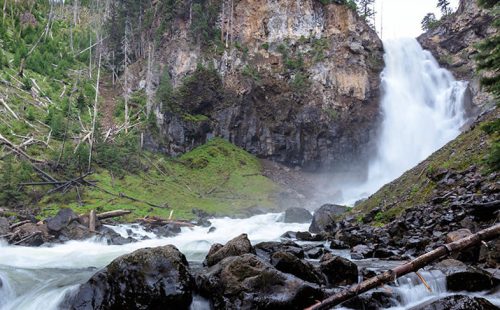
WRAITH FALLS TRAIL

Posted on August 14, 2011 by siteadmin

Trailhead: Pullout ΒΌ mile east of Lava Creek Picnic area, Mammoth-Tower RoadDistance: 1 mile (1 km) round tripLevel of Difficulty:…

Posted in Day Hikes, Mammoth Area
Osprey Falls

OSPREY FALLS TRAIL

Posted on August 14, 2011 by siteadmin

Trailhead: 5 miles south of Mammoth on the Old Bunsen Peak Road TrailDistance: 8 miles (12.9 km) roundtripLevel of Difficulty:…
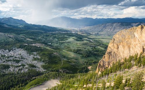
Posted in Day Hikes, Mammoth Area

BUNSEN PEAK TRAIL

Posted on August 13, 2011 by siteadmin

Trailhead: Entrance of Old Bunsen Peak Road, 5 miles south of MammothDistance: 2 miles to the summit (up to 10…

Posted in Day Hikes, Mammoth Area
Beaver Pond

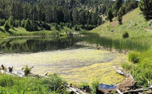
BEAVER PONDS LOOP TRAIL

Posted on August 13, 2011 by siteadmin

Trailhead: Clematis Gulch between Liberty Cap and the stone houseDistance: 5 mile (8 km) loopLevel of Difficulty: Moderate One of…

Posted in Day Hikes, Mammoth Area
Powered by Miniva WordPress Theme