
Trailhead: 1.25 miles NE of Tower Junction on the road to the NE Entrance Distance: 3.7 miles (5.9 km) roundtrip Level of difficulty: Moderately strenuous A moderate trail which starts…
Category: Day Hikes
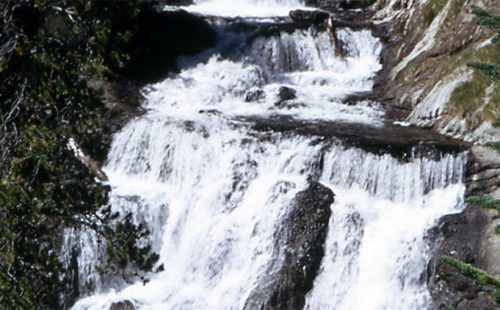
WRAITH FALLS TRAIL
Trailhead: Pullout ¼ mile east of Lava Creek Picnic area, Mammoth-Tower RoadDistance: 1 mile (1 km) round tripLevel of Difficulty: Easy This short, easy hike takes only minutes. It travels…
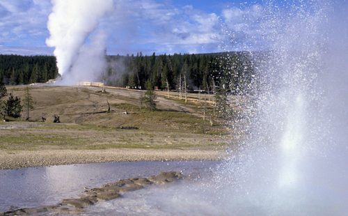
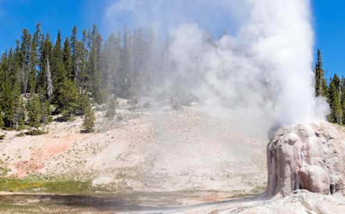
UPPER GEYSER BASIN TRAILS
Trailhead: Boardwalk in front of Old Faithful Visitor CenterDistances: Several miles of trails, including a loop to the east and one to the westLevel of Difficulty: Easy Although Old Faithful…
STORM POINT TRAIL
Trailhead: Pullout at Indian Pond, 3 miles east of Fishing Bridge Visitor CenterDistance: 2 mile (3 km) loopLevel of Difficulty: Easy If you would like to get a good…
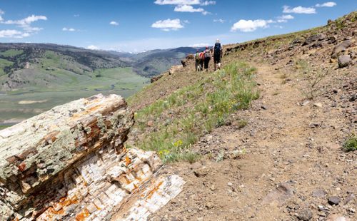
SPECIMEN RIDGE TRAIL
Trailhead: 2.5 miles east of Tower JunctionDistance: 1 to 11 miles one wayLevel of Difficulty: Moderate to DifficultThis is a moderate trail which takes one to the lip of the…
SOLFATARA CREEK TRAIL
Trailhead #1: Loop C in Norris Campground Trailhead #2: approx. 3/4 mile south of Beaver Lake Picnic Area Distance: About 13 miles round trip Level of Difficulty: Easy to moderate;…
PELICAN CREEK TRAIL
Trailhead: West end of Pelican Creek Bridge, 1 mile (1.5 km) east of Fishing Bridge Visitor CenterDistance: 1 mile (1.5 km) loopLevel of Difficulty: EasyThis very short but scenic trail…
OSPREY FALLS TRAIL
Trailhead: 5 miles south of Mammoth on the Old Bunsen Peak Road TrailDistance: 8 miles (12.9 km) roundtripLevel of Difficulty: Difficult Whether you start south of Bunsen Peak on the…
OBSERVATION POINT TRAIL
OBSERVATION POINT TRAIL Trailhead: Firehole River footbridge behind Old Faithful GeyserDistance: 1.1 mile (1 km) loopLevel of Difficulty: Moderate This loop trail gains about 200 feet in elevation to a…

NATURAL BRIDGE TRAIL
Trailhead: Bridge Bay Marina parking lot near the campground entrance roadDistance: 3 miles (5 km) roundtripLevel of Difficulty: EasyThe natural bridge is a 51 feet high cliff of rhyolite rock…
MYSTIC FALLS TRAIL
How to Get There The falls are located behind Biscuit Basin, near the Old Faithful Area. After about .5 miles, the trail takes a fork. The left-hand fork goes directly…
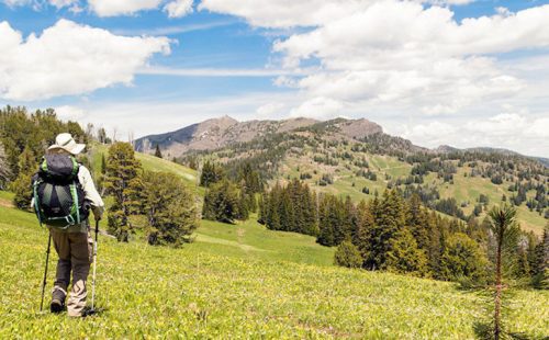
MOUNT WASHBURN TRAIL
Trailhead #1: Chittenden Road Parking Area, 8.7 miles (13.9 km)Trailhead #2: Dunraven Pass Parking Area, 13.6 miles south of Tower JunctionDistance: 6 miles (9.6 km) roundtripLevel of difficulty: Moderately strenuousOne…
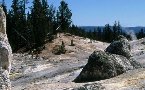
MONUMENT GEYSER BASIN TRAIL
Trailhead: 5 miles south of Norris Junction on the Norris-Madison road, just after Gibbon River BridgeDistance: 2 miles (3 km)Level of Difficulty: Difficult (don’t be fooled by the initial easy…

MARY MOUNTAIN TRAIL
Trailhead: North of Alum Creek pullout, 4 miles south of Canyon JunctionDistance: 21 miles one wayLevel of Difficulty: Moderately strenuous if you do the entire hike in one day Mary…

MALLARD LAKE TRAIL
Trailhead: Old Faithful Lodge cabin areaDistance: 6.8 miles (5.3 km) roundtripLevel of Difficulty: Moderate This trail climbs through lodgepole pine forest, some of which was burned in the 1988 fires,…
LOST LAKE TRAIL
Trailhead: Behind Roosevelt LodgeDistance: 4 miles (6.4 km) roundtripLevel of difficulty: Moderately strenuousThis moderately strenuous trail starts behind Roosevelt Lodge (Tower Junction) and goes into the forested hillside and climbs…
LONE STAR GEYSER TRAIL
Trailhead: 3.5 miles SE of the Old Faithful area, at Kepler Cascades parking areaDistance: 5 miles (8 km) roundtripLevel of Difficulty: Easy One of the easiest five mile roundtrip hikes…
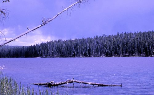
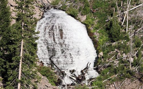
ICE LAKE TRAIL
Trailhead: 3.5 miles east of Norris on the Norris-Canyon roadDistance: 0.3 miles (0.5 km)Level of Difficulty: Easy; handicapped accessible backcountry site on lake Ice Lake is a beautiful, small lake…
GRIZZLY LAKE TRAIL
Trailhead: 1 mile (1 km) south of Beaver Lake on the Mammoth-Norris roadDistance: 4 miles (6 km) roundtripLevel of difficulty: Moderate with some short, steep climbs and rolling terrain.Note: A…
GREBE LAKE TRAIL
Trailhead: 3.5 miles (5.6 km) west of Canyon Junction on the Norris-Canyon RoadDistance: 6 miles (9.7 km) roundtripLevel of Difficulty: Moderately easyMainly used by fishermen and backpackers, this trail goes…