Welcome to My Blog. This is your first post. Edit or delete it, then start writing!
Author: siteadmin
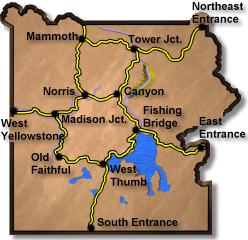
Interesting Yellowstone Street Views
Select a new starting point – Links will open in above window
Barefoot Blonde in Blue Chevron Dress
Bear Jam near Gibbon Meadows
West Entrance Hitchhikers
Four armed person at Lewis Falls
South Entrance Road Fire
Here are some interesting scenes we have found on Google Street Views in Yellowstone National Park
Click on any road section for more.
Canyon to Norris
Select a new starting point – Links will
open in above window
Leaving Canyon Jct
Along the road
Ice Lake Trailhead
Virgina Cascades Road
Crossing Gibbon River
Approching Norris Jct
Click on any road section for more.
This section of road is a crossover to the other side of the Park. It reaches an elevation of 8,257ft. The road passes by the turn of the Virginia Cascades Drive.
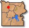
West Thumb to South Entrance
West Thumb to South Entrance
Select a new starting point – Links will open in above window
Grant Village Turnoff
South Entrance Road
Lewis Lake
Lewis Falls
Moose Falls
South Entrance
Click on any road section for more.
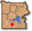
The South Entrance to Yellowstone leads from Grand Tetons National Park and the Rockefeller Memorial Parkway. A short distance from the south entrance is Moose Falls. Here Crawfish Creek tumbles down from the plateau toward the deep canyon of the Lewis River. Lewis Falls is another beautiful spot as it plunges 37 feet.
Fishing Bridge to East Entrance
Select a new starting point – Links will open in above window
Just East of Fishing Bridge
Mary Bay
Steamboat Point
Near Cub Creek
Sylvan Lake
Sylvan Pass
East Entrance
Click on any road section for more.
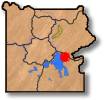
The East Entrance Road passes thru some of the most beautiful alpine scenery in all of Yellowstone. The entrance is at 7,200 feet and the road climbs to 8,541 feet. Sylvan Lake is a popular stop along the East Entrance Road.
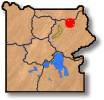
Norris Jct to Madison Jct
Norris Jct to Madison Jct
Select a new starting point – Links will open in above window
Just South of Norris Jct
Gibbon Meadows #1
Gibbon Meadows #2
Beryl Spring
Gibbon Falls
Terrace Spring
Approaching Madison Jct
Click on any road section for more.
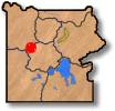
Norris Geyser Basin is the hottest most dynamic in all of Yellowstone. It’s star feature is Echinus Geyser. Echinus erupts to heights of 75 feet with an interval between 25 and 45 minutes.
The road leads thru Elk Park and Gibbon meadows. This is a good area to see elk and bison.
Beautiful Gibbon Falls drops 84 feet as it glides over the worn rock to the river below
A short trail from Gibbon meadow leads to the Artist Paint Pots.
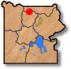
Mammoth Hot Spring to Norris Jct
Mammoth Hot Spring to Norris Jct
Select a new starting point – Links will open in above window
Near Liberty Cap
Silver Gate
Golden Gate
Swan Lake
Obsidian Cliff
Roaring Mountain
Approaching Norris Jct
Click on any road section for more.
Here at Mammoth Hot Springs, water doesn’t erupt like in the geyser basins but flows, gently from cracks. Hot water dissolves the underlying limestone and deposits it on the surface forming these huge terraces. As we leave Mammoth Hot Spring heading south, the road passes thru Golden Gate. The road passes by Obsidian Cliff, a “mountain of glass”. This rock formation is the same as rhyolite, but in this case, the rhyolite cooled so quickly that it did not crystalize. Instead, black glass was formed.
Mammoth Hot Springs to Gardiner
Mammoth Hot Springs to Gardiner
Select a new starting point – Links will open in above window
Heading North from Mammoth Hot Springs
Mammoth Campground
Boiling River
Gardiner Canyon
Gardiner Canyon #2
North Entrance
Roosevelt Arch
Click on any road section for more.
The North Entrance Road from Mammoth Hot Springs runs along the Gardner River. The road winds down the Gardner River canyon, past crumbling walls of sandstone and ancient mudflows. The vegetation is much thicker in the canyon than on the open prairie down below, the common trees being Rocky Mountain juniper, cottonwood, and Douglas-fir. Low-growing willows also crowd the river’s edge in the flatter, flood-prone sections of the canyon.
Tower Jct to Cooke City
Tower Jct to Cooke City
Select a new starting point – Links will open in above window
Crossing the Yellowstone River
Northeast Entrance Road
Crystal Creek/Lamar River
Lamar Ranger Station
Soda Butte
Near Pebble Creek
Soda Butte Creek
Northeast Entrance
Click on any road section for more.
The Northeast Entrance road passes thru beautiful Lamar Valley, with views of the Absaroka Mountains towering above you. Soda Butte is a terrace of calcium carbonate and was formed by hot water dissolving the underlying limestone and bringing it to the surface.
Tower Jct to Mammoth Hot Springs
Tower Jct to Mammoth Hot Springs
Select a new starting point – Links will open in above window
Leaving Tower Jct
Floating Island Lake
Near Geode Creek
Blacktail Ponds
Crossing Yellowstone River
Approaching Mammoth Hot Springs
Click on any road section for more.
This section of road is open year round and passes over the Blacktail plateau before it descends into Mammoth Hot Springs.