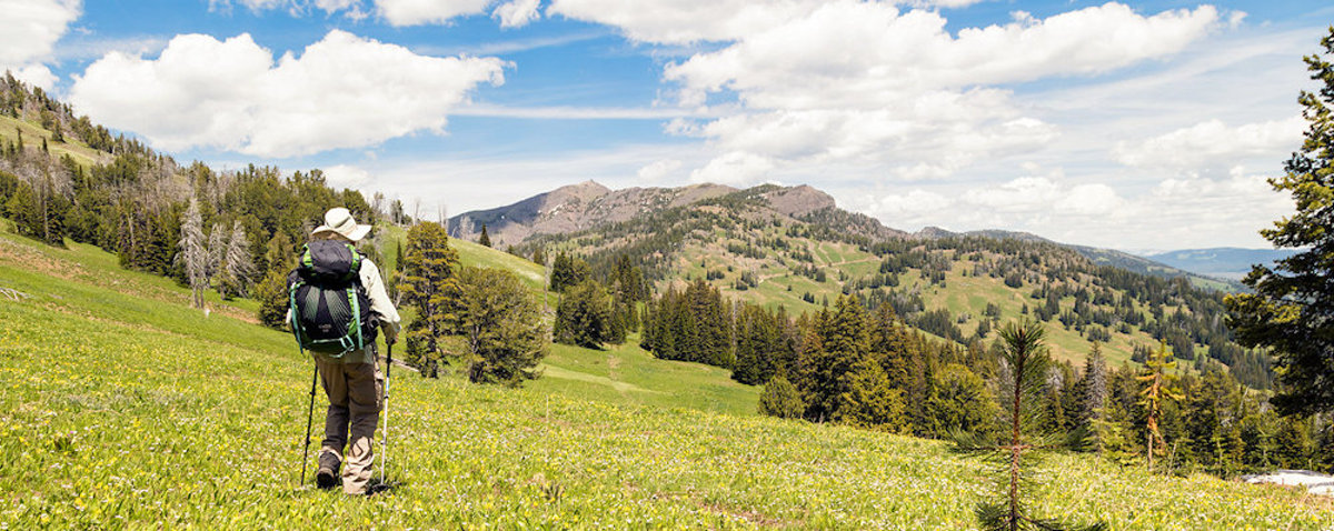
OSPREY FALLS TRAIL

Osprey Falls

Trailhead: 5 miles south of Mammoth on the Old Bunsen Peak Road TrailDistance: 8 miles (12.9 km) roundtripLevel of Difficulty: Difficult Whether you start south of Bunsen Peak on the old Bunsen Peak road (the trailhead noted above) or north of Bunsen Peak on the other end of the old Bunsen Peak road, you will … Read more

OBSERVATION POINT TRAIL

Old Faithful from Observation Point

OBSERVATION POINT TRAIL Trailhead: Firehole River footbridge behind Old Faithful GeyserDistance: 1.1 mile (1 km) loopLevel of Difficulty: Moderate This loop trail gains about 200 feet in elevation to a prominent overlook providing a great view of the Upper Geyser Basin.  Elk and bison are often in the area, and it is not unusual to … Read more

NATURAL BRIDGE TRAIL

Natural Bridge

Trailhead: Bridge Bay Marina parking lot near the campground entrance roadDistance: 3 miles (5 km) roundtripLevel of Difficulty: EasyThe natural bridge is a 51 feet high cliff of rhyolite rock that has been cut through by the process of erosion in nearby Bridge Creek. The trail from the campground traverses a forested area for 1.2 … Read more

MYSTIC FALLS TRAIL

Mystic Falls

How to Get There The falls are located behind Biscuit Basin, near the Old Faithful Area.   After about .5 miles, the trail takes a fork.  The left-hand fork goes directly to Mystic Falls and is about one mile long.  It is an easy hike.  The right-hand fork also goes to the Falls, but is nearly … Read more

MOUNT WASHBURN TRAIL

Trailhead #1: Chittenden Road Parking Area, 8.7 miles (13.9 km)Trailhead #2: Dunraven Pass Parking Area, 13.6 miles south of Tower JunctionDistance: 6 miles (9.6 km) roundtripLevel of difficulty: Moderately strenuousOne of the most popular hikes in Yellowstone, the Mt. Washburn trail offers expansive views of the eastern side of the park on clear, summer days. … Read more

MONUMENT GEYSER BASIN TRAIL

monument geyser basin

Trailhead: 5 miles south of Norris Junction on the Norris-Madison road, just after Gibbon River BridgeDistance: 2 miles (3 km)Level of Difficulty: Difficult (don’t be fooled by the initial easy going)This is a short but steep hike which is rated as difficult. Sometimes a walking stick left by previous visitors can be found at the … Read more

MARY MOUNTAIN TRAIL

bison

Trailhead: North of Alum Creek pullout, 4 miles south of Canyon JunctionDistance: 21 miles one wayLevel of Difficulty: Moderately strenuous if you do the entire hike in one day Mary Mountain has two trailheads:  the eastern trail (noted above) climbs gradually up over Mary Mountain and the park’s Central Plateau to the Nez Perce trailhead … Read more

MALLARD LAKE TRAIL

Trailhead: Old Faithful Lodge cabin areaDistance: 6.8 miles (5.3 km) roundtripLevel of Difficulty: Moderate This trail climbs through lodgepole pine forest, some of which was burned in the 1988 fires, and along meadows and several rocky slopes before reaching the shores of  Mallard Lake, a nice little scenic lake.  If you are staying in the … Read more

LOST LAKE TRAIL

lost lake trail

Trailhead: Behind Roosevelt LodgeDistance: 4 miles (6.4 km) roundtripLevel of difficulty: Moderately strenuousThis moderately strenuous trail starts behind Roosevelt Lodge (Tower Junction) and goes into the forested hillside and climbs some 300 feet before coming to a fork. Take the west fork, which leads to Lost Lake in about a quarter of a mile. Waterfowl … Read more

LONE STAR GEYSER TRAIL

Lone Star Geyser

Trailhead: 3.5 miles SE of the Old Faithful area, at Kepler Cascades parking areaDistance: 5 miles (8 km) roundtripLevel of Difficulty: Easy One of the easiest five mile roundtrip hikes in Yellowstone, this mostly level trail follows an old service road along the Firehole River through unburned forests of lodgepole pine. Lone Star geyser erupts … Read more