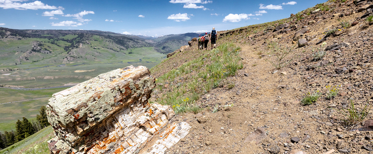
YELLOWSTONE RIVER PICNIC AREA TRAIL

Trailhead: 1.25 miles  NE of Tower Junction on the road to the NE Entrance Distance: 3.7 miles (5.9 km) roundtrip Level of difficulty: Moderately strenuous A moderate trail which starts at the Yellowstone River Picnic Area and rises up to the eastern lip of the Grand Canyon of the Yellowstone, following the rim of the … Read more

WRAITH FALLS TRAIL

Trailhead: Pullout ¼ mile east of Lava Creek Picnic area, Mammoth-Tower RoadDistance: 1 mile (1 km) round tripLevel of Difficulty: Easy This short, easy hike takes only minutes.  It travels through open sagebrush and Douglas-fir forest to the foot of Wraith Falls cascade on Lupine Creek.  It is a good option for families with young … Read more

UPPER GEYSER BASIN TRAILS

Trailhead: Boardwalk in front of Old Faithful Visitor CenterDistances: Several miles of trails, including a loop to the east and one to the westLevel of Difficulty: Easy Although Old Faithful Geyser, the most famous geyser in the park, is located in this area, the trails oriented around Old Faithful Village offer the opportunity to see … Read more

STORM POINT TRAIL

Trailhead: Pullout at Indian Pond, 3 miles east of Fishing Bridge Visitor CenterDistance: 2 mile (3 km) loopLevel of Difficulty: Easy   If you would like to get a good view of Yellowstone Lake off the beaten path, without expending much effort, this could be the trail for you. This easy trail starts at the … Read more

SPECIMEN RIDGE TRAIL

Specimen Ridge

Trailhead: 2.5 miles east of Tower JunctionDistance: 1 to 11 miles one wayLevel of Difficulty: Moderate to DifficultThis is a moderate trail which takes one to the lip of the Grand Canyon of the Yellowstone at the one mile point, then turns to the east and gradually climbs through sagebrush and grassy meadows, reaching the … Read more

SOLFATARA CREEK TRAIL

Trailhead #1: Loop C in Norris Campground Trailhead #2: approx. 3/4 mile south of Beaver Lake Picnic Area Distance: About 13 miles round trip Level of Difficulty: Easy to moderate; highest climb is about 400 feet Beginning in the Norris Campground, the trail traverses lodgepole pine forest as it follows Solfatara Creek for a short … Read more

PELICAN CREEK TRAIL

Trailhead: West end of Pelican Creek Bridge, 1 mile (1.5 km) east of Fishing Bridge Visitor CenterDistance: 1 mile (1.5 km) loopLevel of Difficulty: EasyThis very short but scenic trail passes through a forested area to the shore of Yellowstone Lake before looping back across the marsh along Pelican Creek to the trailhead.  The trail … Read more

OSPREY FALLS TRAIL

Osprey Falls

Trailhead: 5 miles south of Mammoth on the Old Bunsen Peak Road TrailDistance: 8 miles (12.9 km) roundtripLevel of Difficulty: Difficult Whether you start south of Bunsen Peak on the old Bunsen Peak road (the trailhead noted above) or north of Bunsen Peak on the other end of the old Bunsen Peak road, you will … Read more

OBSERVATION POINT TRAIL

Old Faithful from Observation Point

OBSERVATION POINT TRAIL Trailhead: Firehole River footbridge behind Old Faithful GeyserDistance: 1.1 mile (1 km) loopLevel of Difficulty: Moderate This loop trail gains about 200 feet in elevation to a prominent overlook providing a great view of the Upper Geyser Basin.  Elk and bison are often in the area, and it is not unusual to … Read more

NATURAL BRIDGE TRAIL

Natural Bridge

Trailhead: Bridge Bay Marina parking lot near the campground entrance roadDistance: 3 miles (5 km) roundtripLevel of Difficulty: EasyThe natural bridge is a 51 feet high cliff of rhyolite rock that has been cut through by the process of erosion in nearby Bridge Creek. The trail from the campground traverses a forested area for 1.2 … Read more